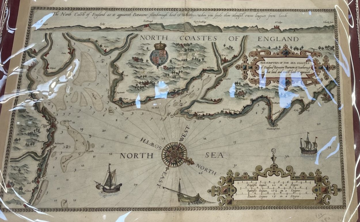
This week on the Secret Library Leeds we bring you a snapshot of a unique treasure held as part of our Special Collections: Lucas Janszoon Waghenaer’s A description of the sea coastes of England between Burnham & Scarborough….This wonderful sea chart was shown to the public during our Local and Family History open day in September, part of the Heritage Open Day Week festival of events. Reproduced here is the information card visitors could see on the day.
A description of the sea coastes of England between Burnham & Scarborough as that land and coast lyeth and appeareth.
Lucas Janszoon Waghenaer (c. 1553-1606)
1588
On verso [Letterpress] : “An exact description of the coastes and channels of Linne, Hull, Filey, Scarborough, with the shoalds and banckes adioyning.”
Lucas Janszoon Waghenaer (c. 1553-1606) was one of many Dutchmen who sailed the trading waters from Holland as far afield as Spain and the Baltic Sea. He retired from the sea in 1579 and began production of charts using the knowledge he had gained.
This particular map is a fine example of the east coast of England from Blakeny in Norfolk to Scarborough in Yorkshire. Identified on the coast are the towns of Burnham, Kings Lynn, Boston, Skegness, Grimsby, Hull, Hornsea, Bridlington and Scarborough amongst others. Across the top of the plate are a series of coastal profiles. The whole is ornately decorated with three ships, one fishing, an ornate compass rose and two cartouche.
Contact the department on 0113 37 86982 or via localandfamilyhistory@leeds.gov.uk to arrange to see Waghenaer’s map.
