- by Philip Wilde, Information and Research, Central Library
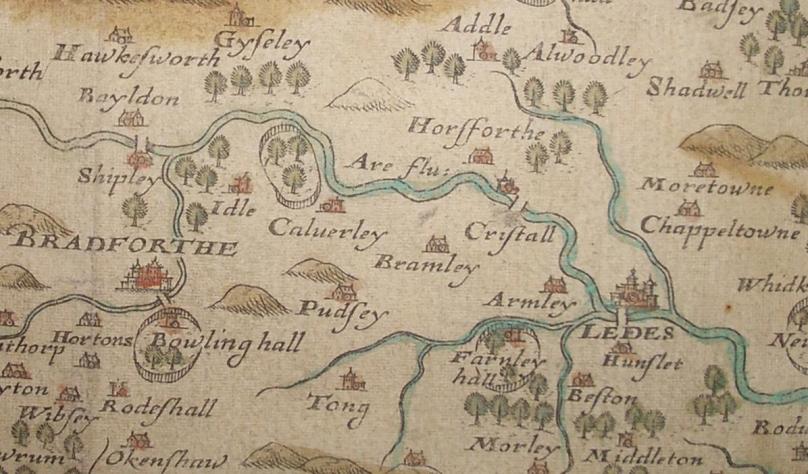
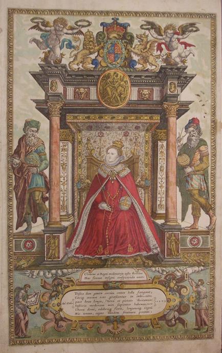
An Atlas of the Counties of England and Wales was published in 1579 and is commonly held to be the first such work of comprehensive mapping; as such, Christopher Saxton is often referred to as the ‘father of English cartography’. Little is known about his personal life, although he was probably born in the Yorkshire parish of Dewsbury in the early 1540s. Later his family moved to Dunningley between Morley and Middleton in the South Leeds area. He began his survey of England in 1574 and of Wales in 1577. The first copper plates were engraved in 1574 and the atlas was completed in 1578. The atlas contains 35 hand coloured maps of the counties of England and Wales. Leeds Central Library is honoured to say that we hold an extremely rare copy of the Saxton Atlas, as well as a 1936 facsimile.
The project was authorized by Queen Elizabeth I. Saxton’s chief financial backer was Thomas Seckford, master of the Queen’s requests. Thomas Chubb, (‘late of the map room, British Museum’) in his 1927 book, Printed Maps in the Atlases of GB & Ireland: 1579-1870, says:
“…[Saxton’s] labours resulted in the fine atlas, dedicated to Queen Elizabeth, which is now one of the most desirable possessions to which the collector of English maps can aspire. If it be not too fanciful one may perhaps compare Saxton’s Atlas in this respect with the position occupied by the first folio of Shakespeare in the eyes of the English book collector; in each case the volume would be the chief jewel and the crowning glory of the collection.”
This atlas formed the basis of all succeeding county maps for over one hundred years. David Fletcher in the Oxford Dictionary of National Biography says:
“That Saxton’s maps were not displaced as the master geographical representation of England and Wales until the Ordnance Survey began publication of one-inch maps in 1801 shows literally that they stood the test of time…”
Further information about Saxton and his Atlas can be found in an informative blog post from the University of Glasgow Library’s Special Collections department.
To view the Saxton Atlas, please visit the Local and Family History department on the 2nd Floor of the Central Library. Two forms of ID (one with your name and another with your address) and at least 24-hours notice will be required to view items from the Treasures or Collections. Please call 0113 378 6982 for further details and to book an appointment.
