The latest in an occasionally-regular series exploring books and other items selected from our vast collections. In this entry Librarian Antony Ramm looks at a collection of materials illuminating a late 18th century election in Yorkshire…
Our previous entry in this series looked at a slim 18th century volume of Yorkshire topography. In this current article we remain in the 1700s – but with a book at almost the complete other end of the size scale – a heavy, thick, folio-sized volume titled Yorkshire Election of Duncombe and Wilberforce and dated 1784. Having not previously encountered this particular book before, the title alone grabbed our attention and inspired further investigation…
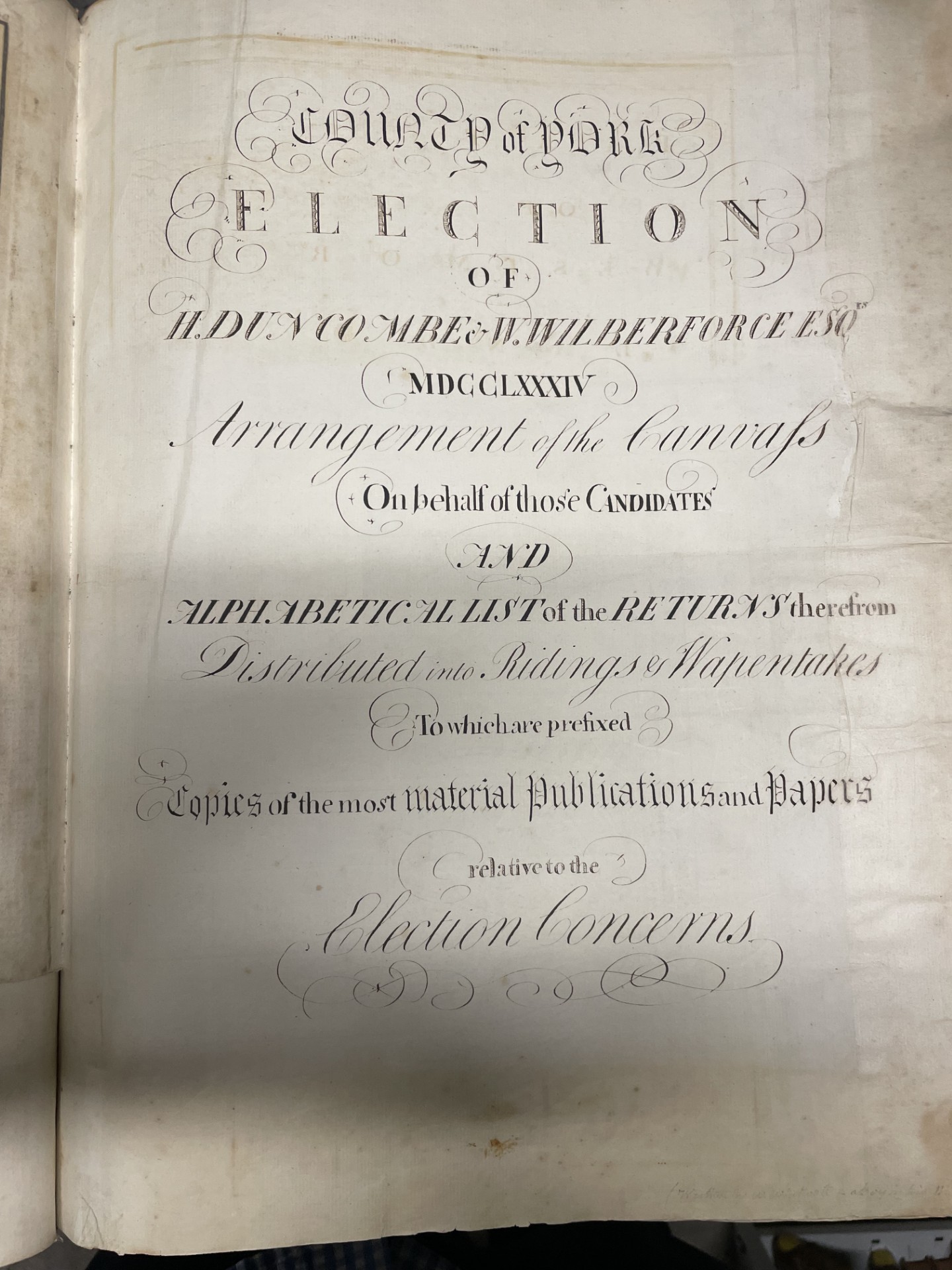
What we found, inside a book more properly called (according to its ornate title page) County of York. Election of H. Duncombe & W. Wilberforce Esq. 1784. Arrangement of the Canvass On Behalf of those Candidates and Alphabetical List of the Returns therefrom Distributed into Ridings & Wapentakes To which are prefixed Copies of the most Material Publications and Papers relative to Election Concerns, was an impressive collection of transcribed materials from the 1784 general election, more specifically papers and documents relating to the Yorkshire seats contested by the now largely-forgotten Henry Duncombe and the very-much remembered William Wilberforce.
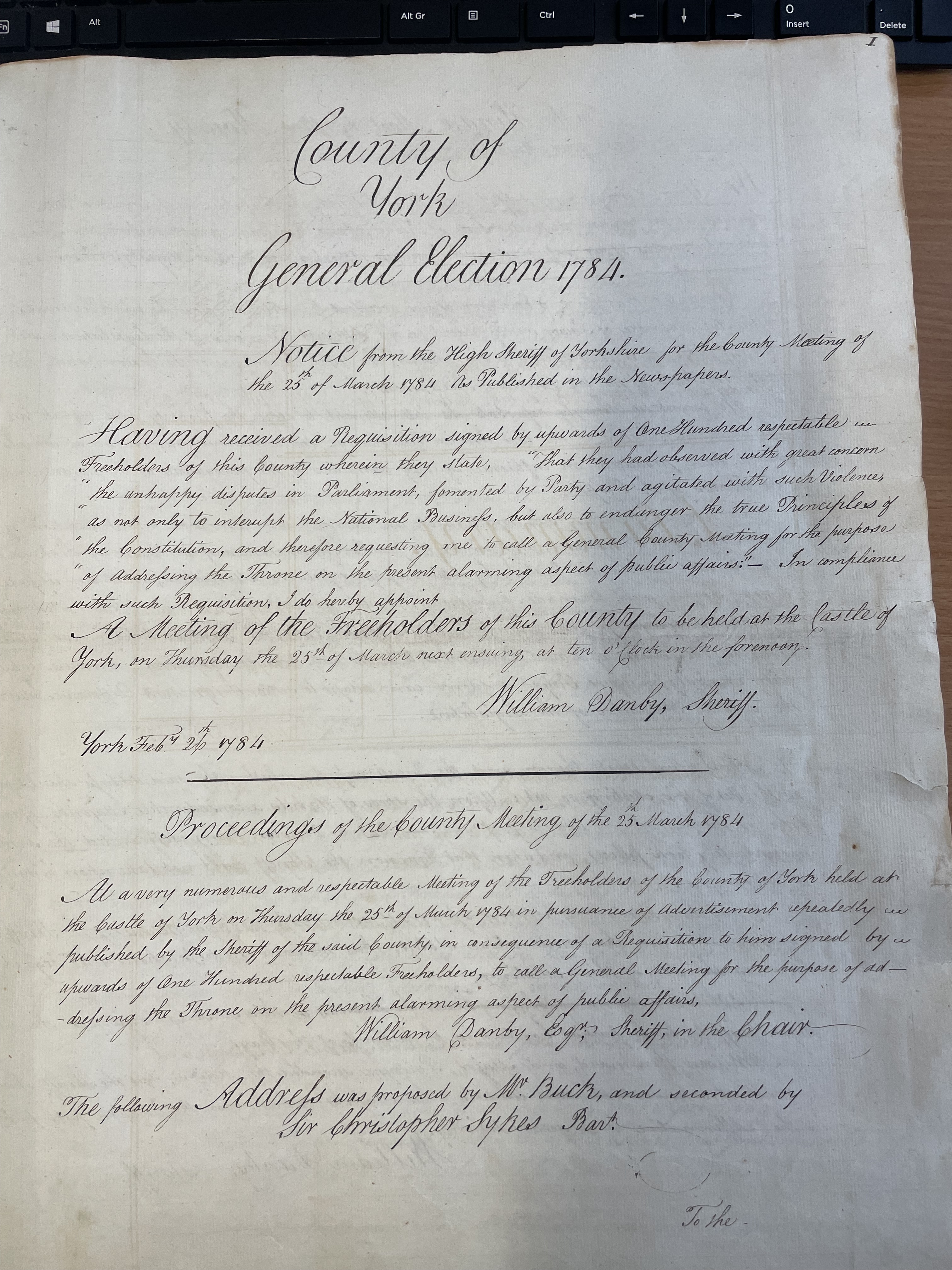
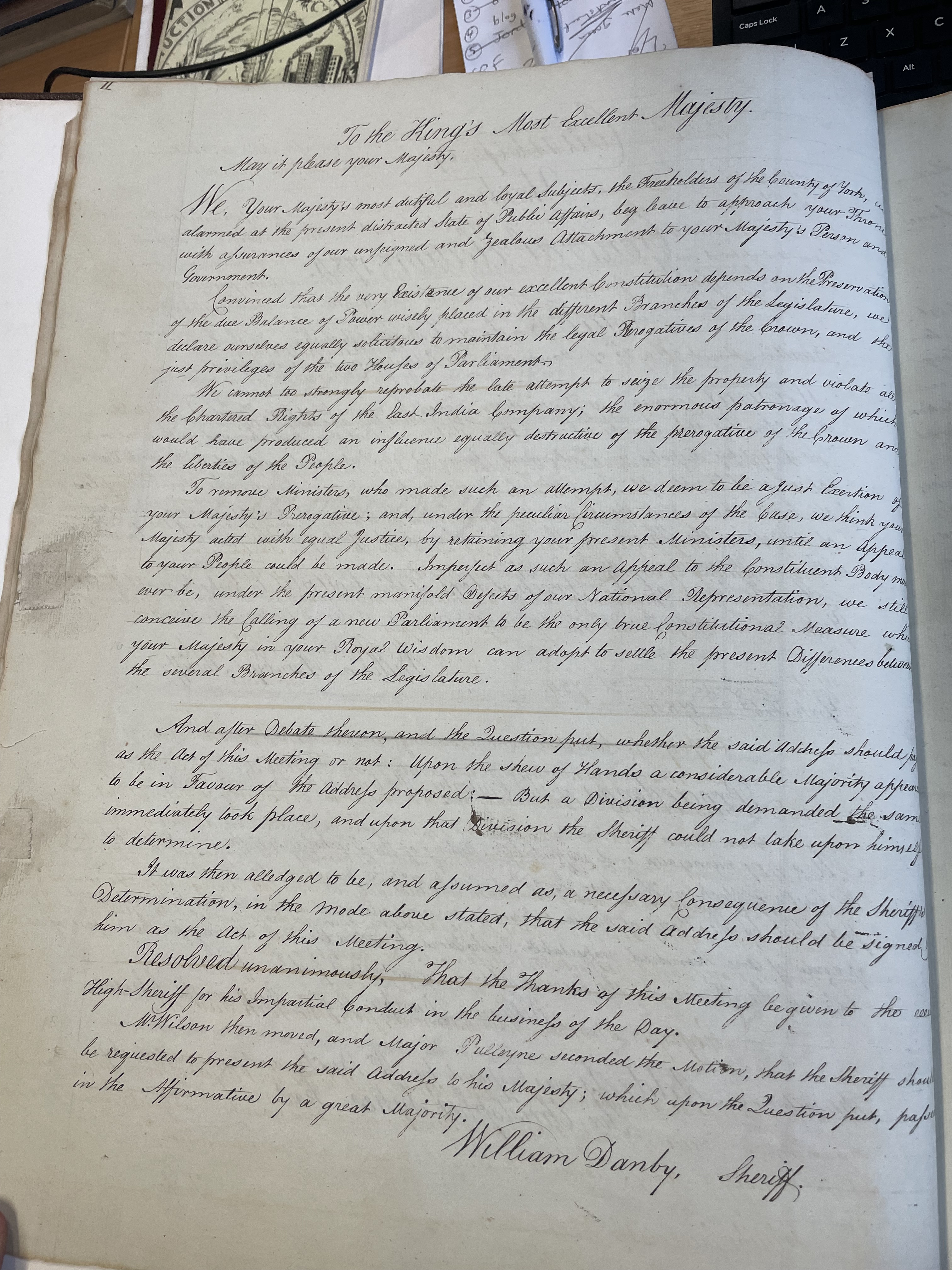
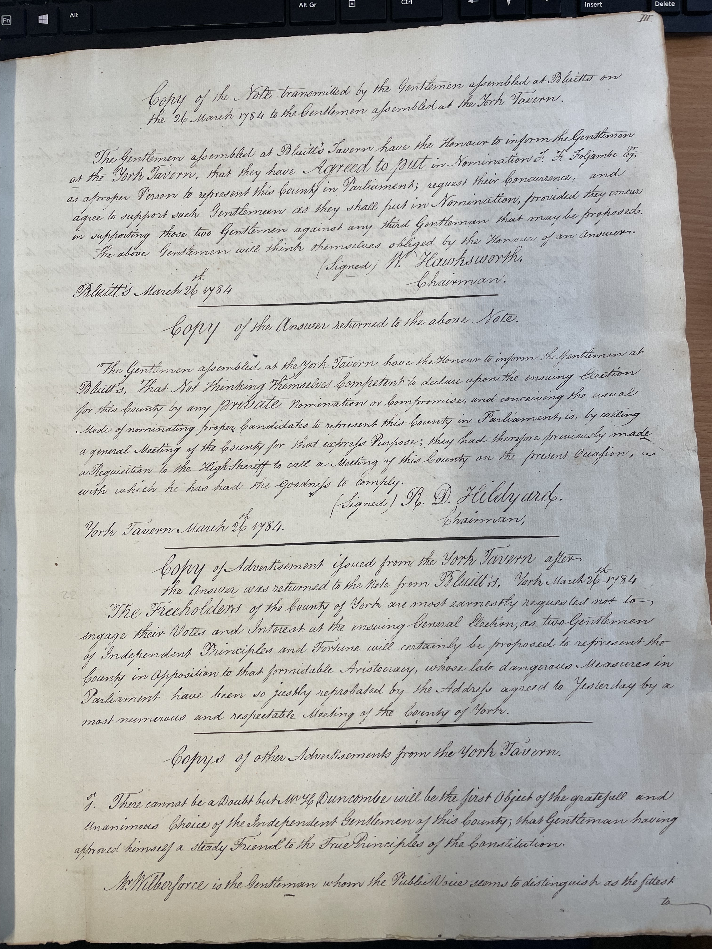
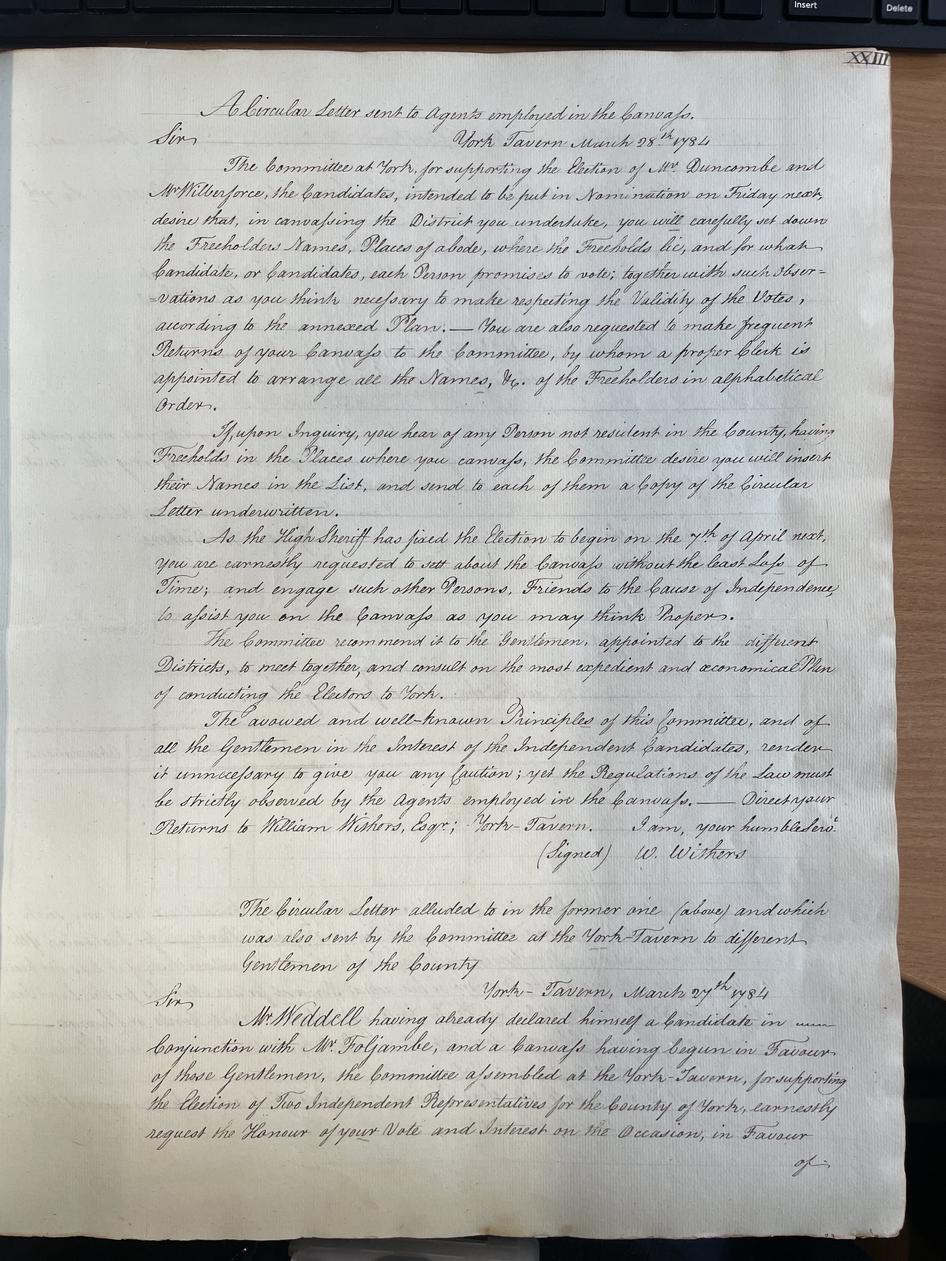
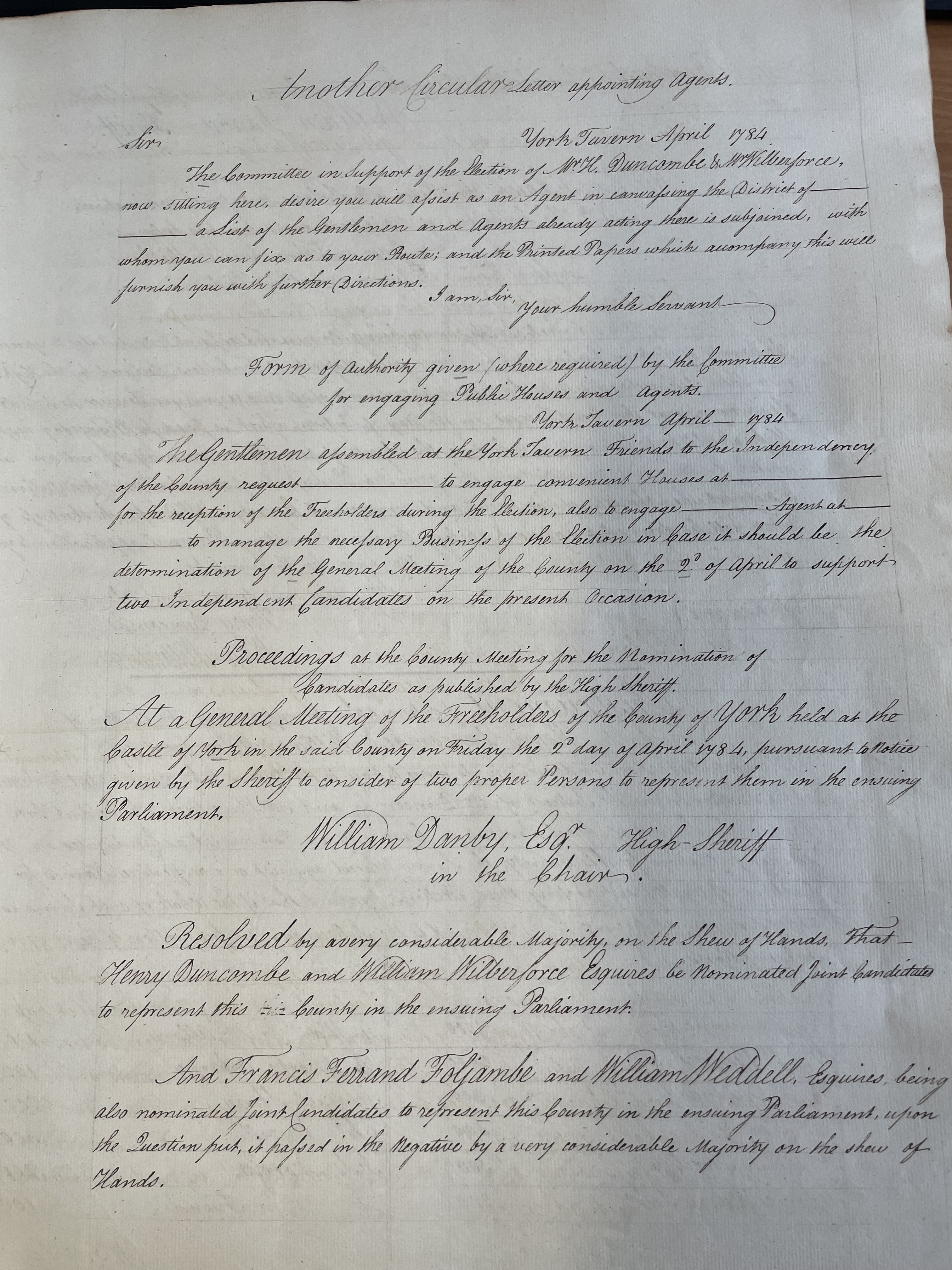
These include copies of advertisements and public notices formalising the election. The main bulk of the material, however, appears concerned with the election of Duncombe and Wilberforce and attempts by ‘Friends’ to maximise votes in their favour. These include names of subscribers supporting their election and nomination, together with amounts pledged to those efforts.
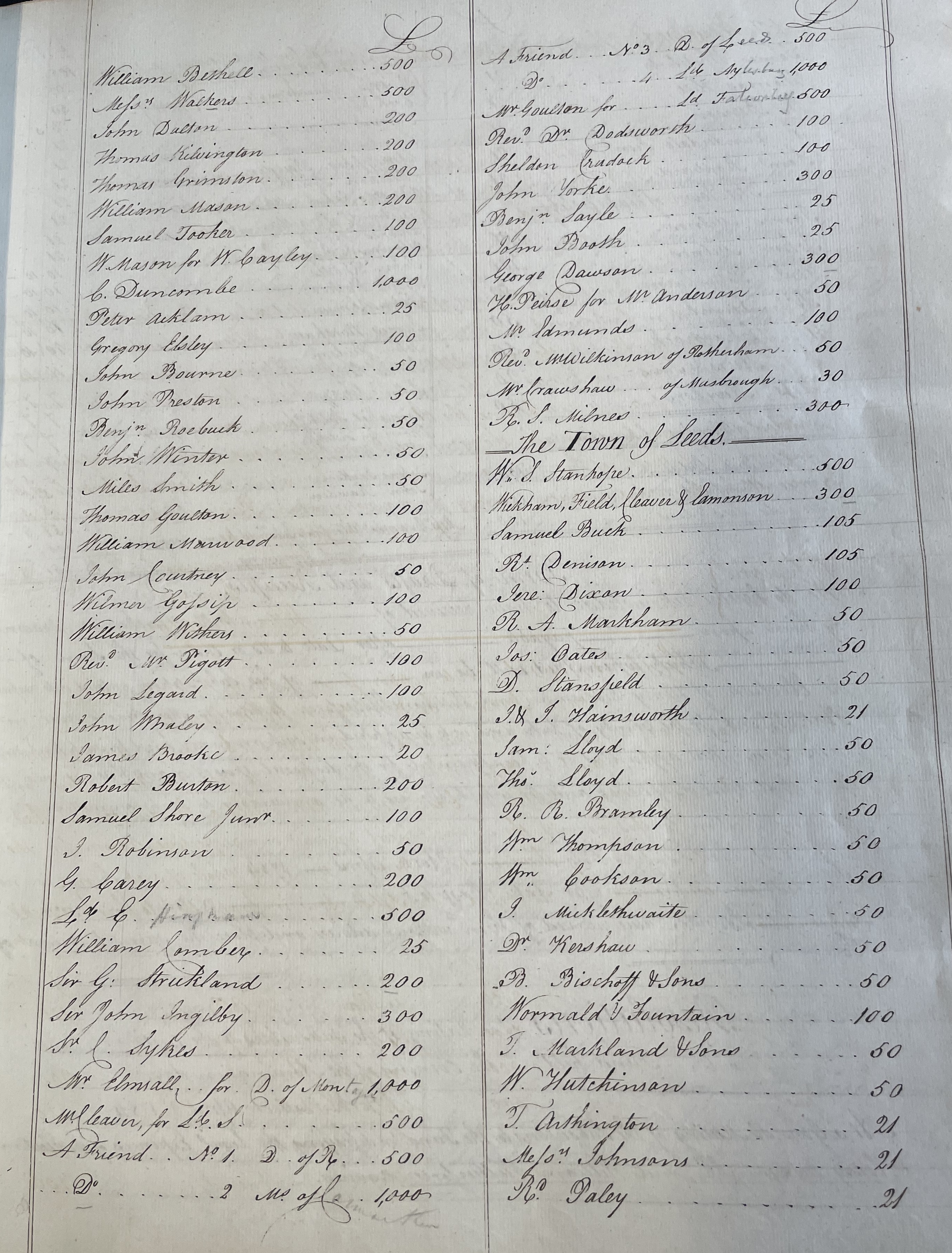
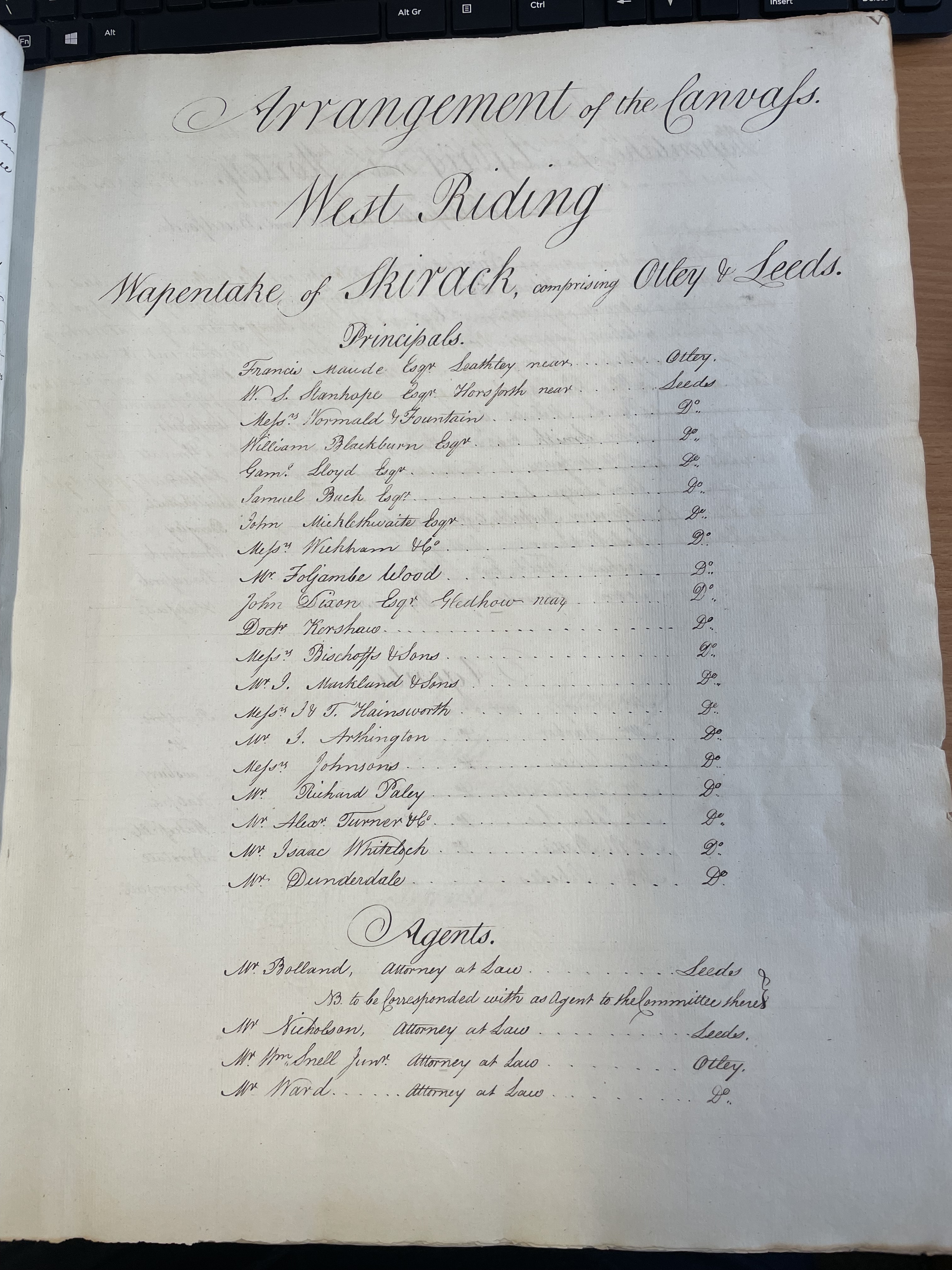
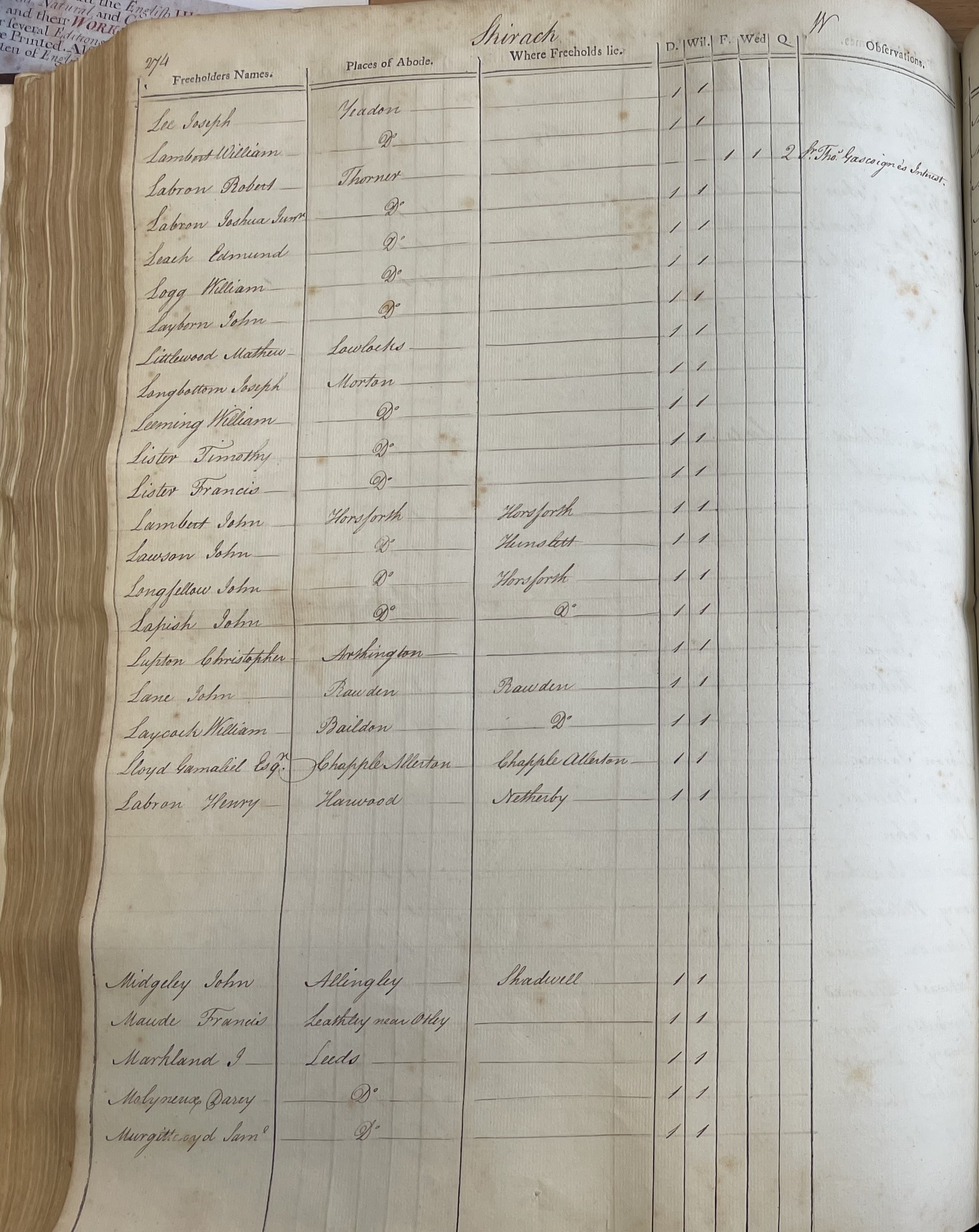
Lists such as this – and others in the same volume, such as the names of people acting as ‘Principals’ or ‘Agents’ in the canvass of votes in the various Wapentakes of Yorkshire (e.g. Skirack – comprising Otley and Leeds) – are invaluable sources of personal information in the pre-1841 period before census returns.
Most importantly in this particular context are the full, alphabetical lists of voters across Yorkshire, with the added bonus of information about their place of abode, as well as the details of who they actually voted for. (Admittedly a standard piece of information in this pre-secret ballot era, but still wonderful to see captured in this manner).
We don’t know very much at all about this volume, why it was created and how it found its way into the collections at Leeds Central Library. Clearly there is enough ‘Leeds material’ in its pages to justify its acquisition, though where it lived before making its home in our Special Collections is not currently known.
Two manuscript copies of letters pasted on the inner pages of the volume, however, give us a few clues:
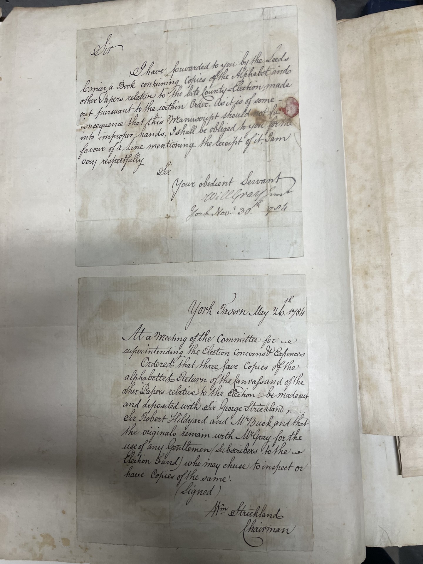
These are written by Mr Gray and Mr Strickland and read as follows:
I have forwarded to you by the Leeds courier a book containing copies of the alphabet and other papers relative to the late County election, made out pursuant to the within Order. As it is of some consequence that this manuscript should not fall into improper hands, I shall be obliged to you for the favour of a line mentioning the receipt of it…(November 30 1784)
At a meeting of the committee for the [?] superintending the Election concerns and expenses. Ordered that three fair copies of the alphabeted return of the canvass and of the other papers relative to the election be made out and deposited with Sir George Strickland, Sir Robert Hildyard and Mr Buck, and that the originals remain with W Gray for the use of any gentlemen/subscribers to the election fund who may chose to inspect or have copies of the same…(May 26 1784)
Perhaps our volume is one of the three held by Sir George, Sir Robert, or Mr Buck?
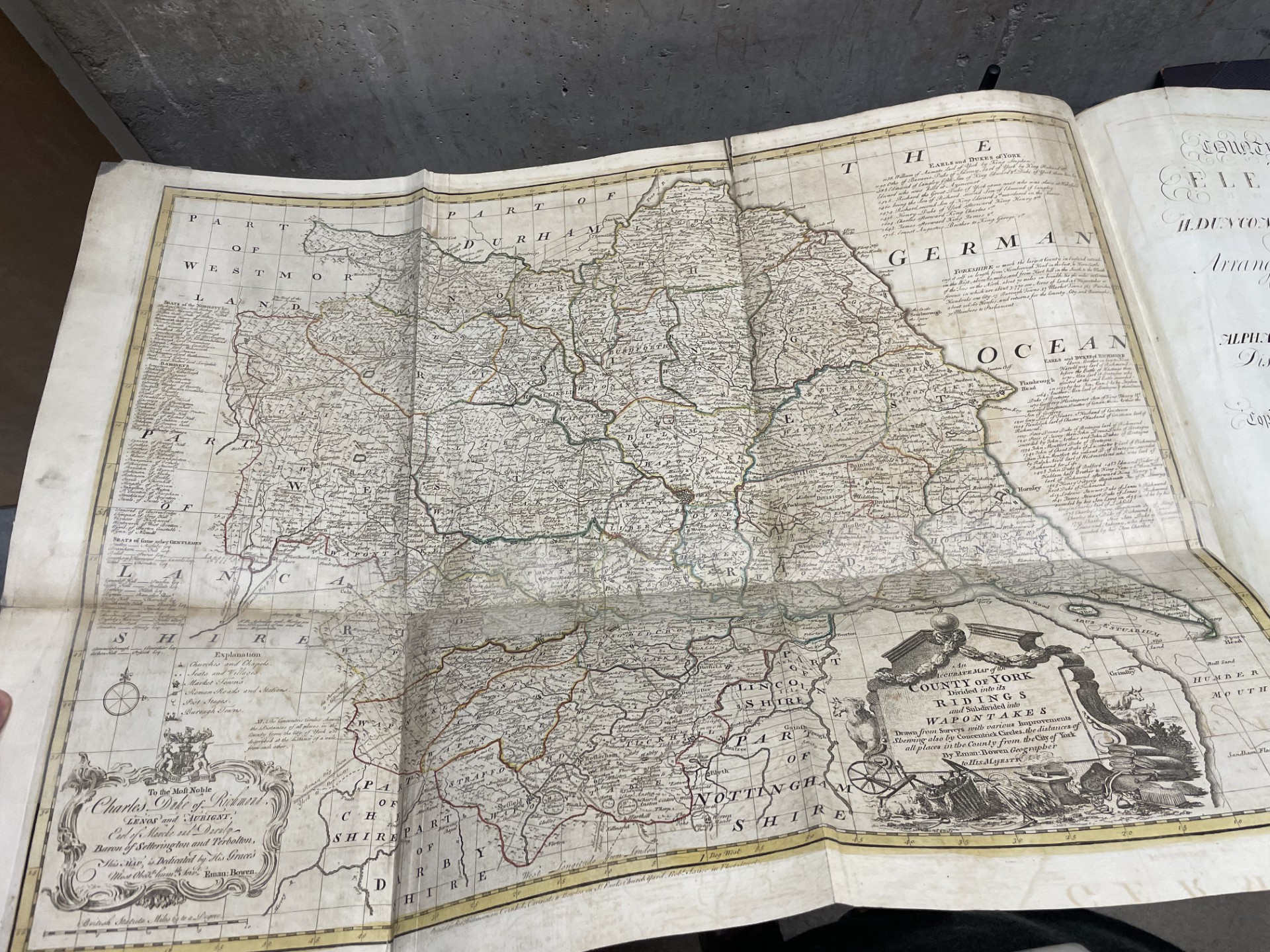
Either way, the most impressive aspect of this volume is neither these letters nor even the important lists of Yorkshire people. Instead, the real treasure of this book is the large foldout map near the start, a wonderful example of an 18th century work by the Welsh map engraver Emanuel Bowen, Royal Mapmaker to both to King George II of Great Britain and Louis XV of France. This map alone is worth seeing, and is a fine complement to our existing collection of important cartography – including our rare copies of Christopher Saxton’s Atlas of the Counties of England and Wales (1579) and Herman Moll’s The World Described (1708 – 1720). Moll, in fact, is known to have worked with Bowen.
To view this item, please contact our Local and Family History department on 0113 37 86982 or via localandfamilyhistory@leeds.gov.uk

TIL the North Sea used to be called The German Ocean!