This week, we’re taking you on a short walking tour of the city centre – not as it is today, but as it would’ve looked in the early Nineteenth Century – using descriptions taken from the pages of The Leeds Guide of 1806. In the spirit of the original volume, which was printed by Edward Baines and sold by R. Brown of North Parade, we were tempted not to provide any illustrations – but, as usual, our photography website Leodis turned up some interesting (if much later) views that we couldn’t resist throwing in as a bonus feature. Read on, then, for a taste of the Guide’s quirky and sometimes opinionated coverage of individual thoroughfares:
“We shall begin our present survey at the West end of town, where the object that first solicits attention is PARK-PLACE, which is a very elegant range of buildings, with a South aspect, and which commands a very pleasing view of the country, particularly the river Aire; all the houses are built in a very superior style, and are principally inhabited by affluent merchants or gentlemen who have retired from business. The promenade on Park-Place is, without exception, one of the most pleasing in the town.
Immediately to the North of Park-Place is the New Road to Bradford, which was first opened for carriages in the year 1802; this road, besides avoiding much hilly ground saves at least half a mile, in the distance from Leeds to Kirkstall (three miles) where it terminates, and to which place a broad flagged foot path is continued, to the great comfort of pedestrians, particularly on Sundays, when the road is crowded with well dressed people.”

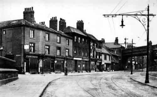
“If we were to estimate the importance of streets by the number of inhabitants they contain, KIRKGATE would certainly claim distinguished notice, as it is extremely populous. But as fashionable people, and with them fashionable tradesmen, have deserted it, this street is fallen into some kind of disrepute, and if it did not happen to be the road to the Church, it would be a place, to adopt a fashionable phrase, which nobody knew; but as it is a wide, and upon the whole a well-built street, it may probably at some future period recover its former consequence.”
“CALL-LANE … is rather a long street, and connects Kirkgate with the bottom of Briggate; though several good houses have lately been erected in this street, its general aspect is but mean, nor does it ever appear to have been a street of any note; it is however the residence of many wool-staplers, being very conveniently situated for that business, as a short street opens from Call-Lane to the White Cloth-Hall, nearly opposite Duncan-Street.
Call-Lane Chapel … has nothing in its exterior appearance to attract attention (unless we add that there is joined to it a very comfortable school-room for the use of Sunday scholars, and where as many as can attend are also taught to write on a Wednesday afternoon).”

That’s where we’re hanging up our walking shoes for now. If you’d like to carry on (and find out, among other things, where exactly “the Swine Market still continues to be held to the great inconvenience of the inhabitants and annoyance of passengers”) you can consult The Leeds Guide in the Local and Family History Library, where it resides at shelf mark SR 914.2819 RYL. And, yes, as you may remember, ‘SR’ stands for ‘Strong Room’, which means we’ll ask you for ID if you want to look at it!
