This week Librarian Antony Ramm analyses some early maps of Leeds. This article is based on a recent talk given by Librarians in the Local and Family History department; it draws in part on two previous articles on this site
A MAP OF ROTHWELL, OULTON AND LOFTHOUSE, MADE IN THE REIGN OF HENRY VIII (1531)
Our story starts with an early 16th-century map: the very oldest local map held in the local history collections of Leeds Central Library. A section of the map can be seen below.
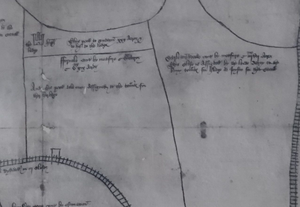
Until relatively recently, this map was catalogued as simply being from the 1500s, but a recent discovery revealed that the actual date of this map has been hiding in plain sight since the 1990s, in an article in the Yorkshire Archaeological Society journal by R.W.Hoyle, entitled ‘Thomas Lord Darcy and the Rothwell Tenants, c. 1526-1534’.
That article reproduces the map in full and provides extensive background and contextual detail for the map and what it actually shows, explaining that it was drawn up by officers of the Crown as part of a legal dispute between Thomas, Lord Darcy of Temple Newsam and local villagers in Rothwell and its surrounding area.
After receiving a grant from Henry VIII of Rothwell’s former manorial hunting park in 1509, Darcy proceeded to ‘improve’ the wooded parkland by converting some of its overgrown woodland into land for the growing of crops. That conflicted with the apparent rights of villagers to use the park as common grazing ground for their cattle. By 1526 locals were objecting to Darcy’s activities and, in 1531, a court ruled that Darcy had to provide a certain amount of land for the villagers for that purpose, land separated from the ‘improved’ land, which was enclosed by hedging, ditches and fences.
That ruling, however, did not seem to satisfy the villagers who continued to lay claim to larger areas of land for cattle crazing. The dispute came to a head on May 3 1532 when 250 men and women from Rothwell proceeded to tear down the fences Darcy’s men had erected. The conflict was eventually resolved in Darcy’s favour when courts ruled that villagers involved in the riots should be fined and ordered to “restrain any of their neighbours who were moved to wreck Darcy’s [park] again.”
The copy at Leeds Central Library of this map is a sanctioned photocopy from the original, held at the National Archives – a copy which makes this important map accessible for local people in the Rothwell and Leeds area. Hoyle dates the map to 1531 – drawn up for the court that made that initial ruling that villagers should have parkland set aside for grazing purposes. Hoyle explains that this map is probably the oldest extant map for the whole of the West Riding.
While the map was initially produced for a legal dispute, it remains useful for researchers and is a good example of how maps produced for very specific purposes in their own time can have an afterlife of continued usage in local and family history research, long after their original purpose has passed. In this case, for instance, the map provides all kinds of detail about the structure of a 16th-century village community in the West Riding.
*****
PLAN OF LEEDS (1560)
Our next map is rather similar, being also concerned with a legal case and also being a photocopy of an original held at the National Archives: a 1560 map, the first map of Leeds proper.
Many readers will have seen this map before, and many will also know its purpose: drawn up as part of a legal dispute between the tenants of the Queen’s Mill and Thomas Falkingham of the North Hall manor, which was carved out of the manor of Leeds itself in the 12th-century. The tenants of the Queen’s flour Mill – a ‘soke’ mill; that is, one with a local monopoly, obliging all tenants of the manor to grind their corn there – alleged that they had suffered financial injury on the erection of a corn mill near to Falkingham’s Hall, situated around the corner of Vicar Lane and Lady Lane. Falkingham, for his part, claimed it was within his rights to build and operate his own mill given it stood within his own manor of North Hall.
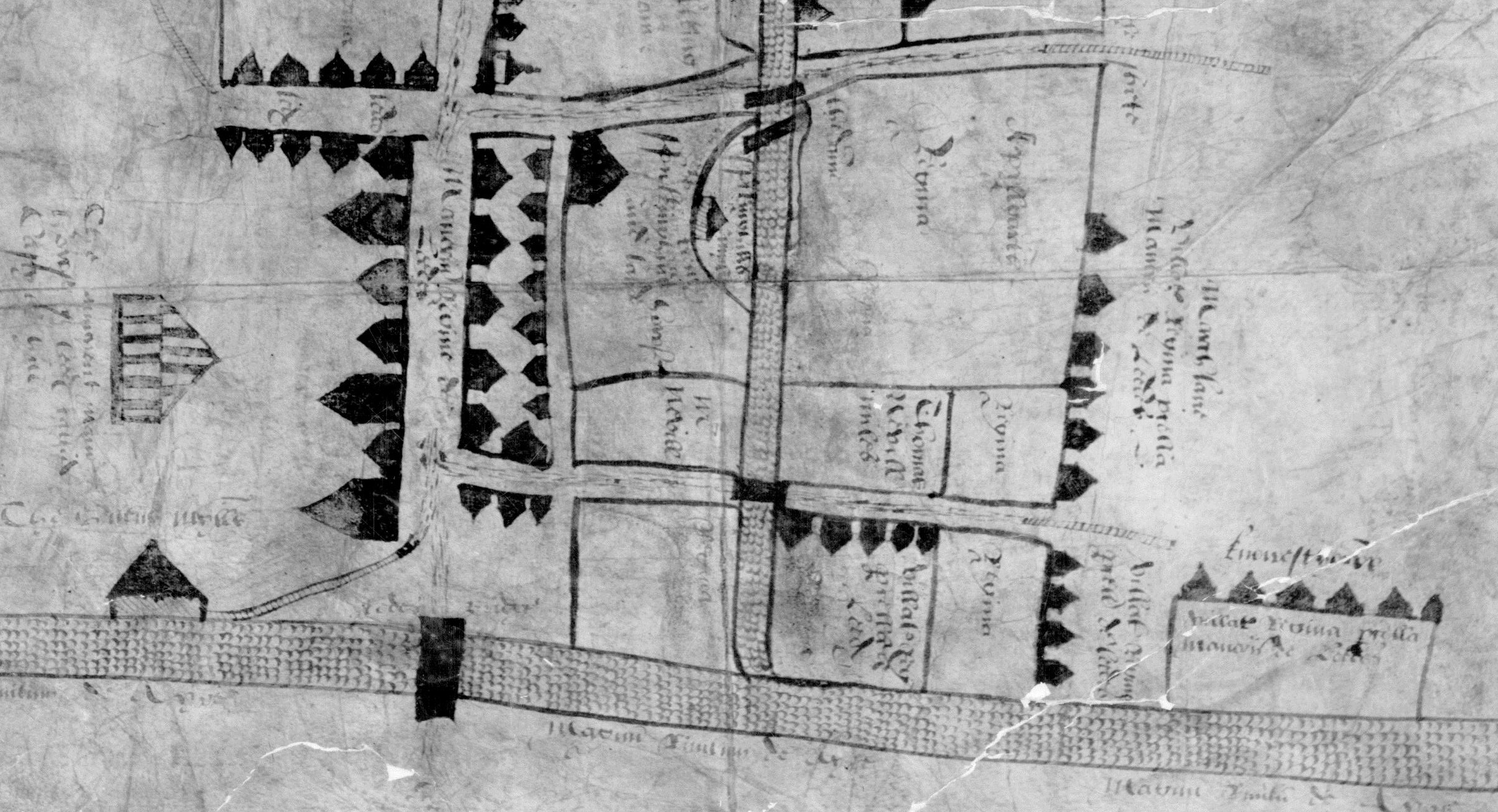
This map was, then, drawn up by Commissioners investigating that dispute; intended to be “a true and perfecte platte of the scituacion of the said myll and stream,” the map was instead a rather “rude sketch”, as Edmund Wilson remarks in his 1897 Thoresby Society article on the case, “with no pretence to accuracy.”

Still, as Wilson himself acknowledges, it remains interesting as the earliest-known map of the town. The east is actually at the top of the map, “as was not unusual in olden times”, again according to Wilson. When rotated, the River Aire is at the bottom, flowing west to east, spanned by a bridge from which Briggate extends northwards until it reaches Upper and Lower Head Row. Just below the latter we find Falkingham’s Hall and Mill and, in the south-west corner, is the Queen’s Mill itself.
Interestingly, and revealingly, the map does not show the Parish Church – but it does show two other mills – evidence, perhaps, of the Commissioner’s true area of interest here: that is, less drawing an accurate plan of the town than in creating a visual inventory of the matter at the heart of the legal dispute.
That’s important because it reminds us that, strangely, maps aren’t often what we necessarily mean when we talk about ‘maps’ – i.e. objective, scientific records of place & space. As family historian Dr. Sophie Kay has said:
It’s easy to fall into the trap of thinking of maps as an unbiased resource, that somehow mapmakers should always have set down the vision in front of them as it stood.
So, that is, instead of being neutral and unbiased, maps always reflect the ideologies of the societies that produce them, much more than they depict any physical ‘reality’. Map-makers seek to impose order onto chaos, setting limits onto space – in doing so they define the boundaries of inclusion and exclusion from certain spheres of activities.
In this sense, then, maps are essentially about knowledge, control and power: struggles over which lie at the heart of all politics. So, that is, maps are always political. That’s certainly the case with the two maps we’ve just looked at, which are essentially about land ownership – who has it and who is claiming it. These maps both represent and create claims to power.
*****
A NEW & EXACT PLAN OF THE TOWN OF LEEDES (c.1726)
And that’s also the case with the next map we’ll briefly explore – another one that many readers will be familiar with: John Cossins’ very-famous 1726 map of Leeds: A New & Exact Plan of the Town of Leedes.
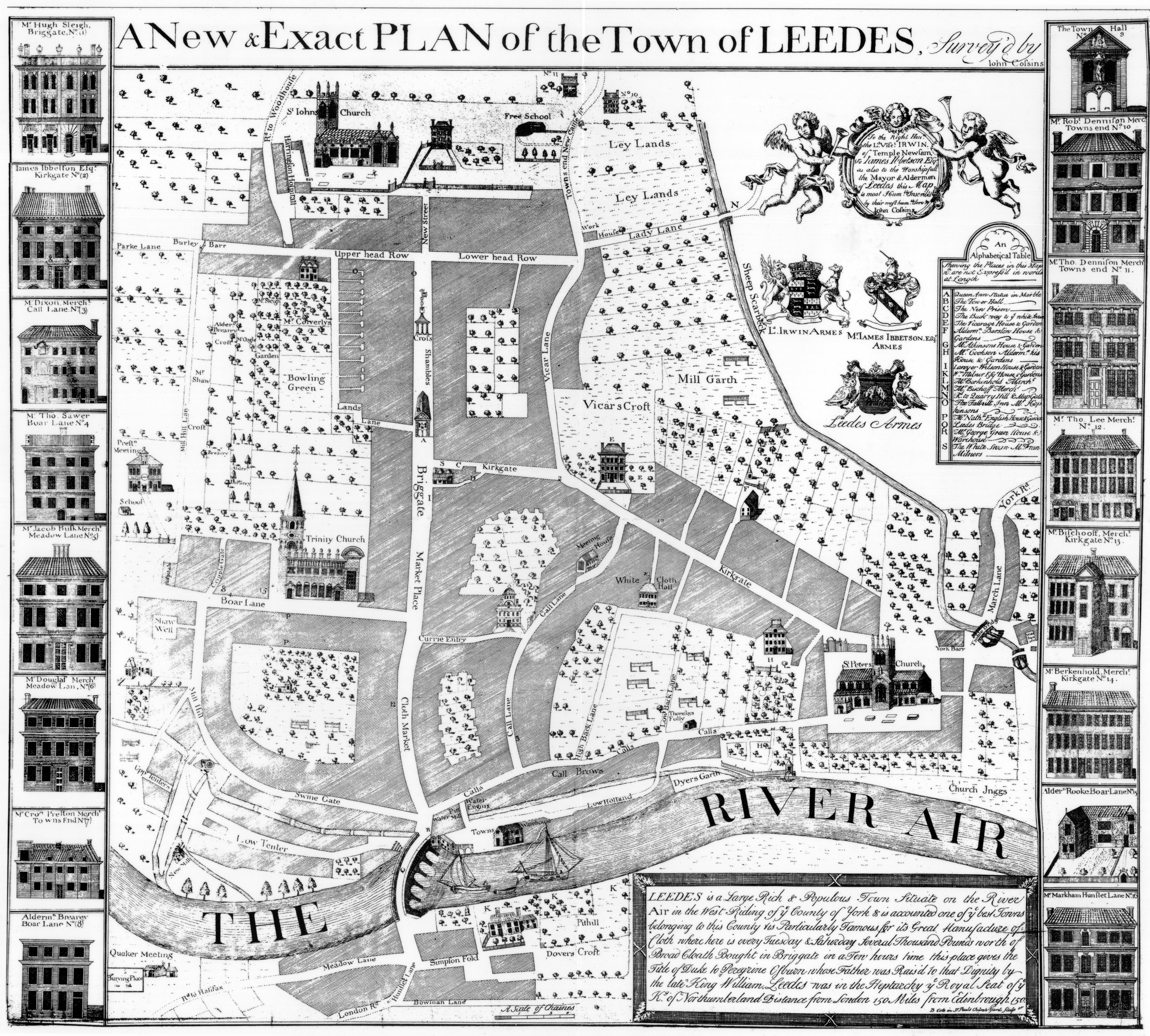
Of course, this is very-much a partial – not ‘Exact’ – representation of 18th-century reality, one defined instead by its border images: the grand homes of those cloth merchants who paid for the map to be made, together with visual representations of the commercial and social spaces important to those elites and their networks: their Churches and their Cloth Halls
Notably absent from the map, however, is any representation of the homes and workshops of the poor. Instead, Cossins simply cross-shaded large areas and, in the process, rendered invisible the existence of non-elite people in Leeds at this time – a reflection, no doubt, of prevailing attitudes among their social ‘betters’.
*****
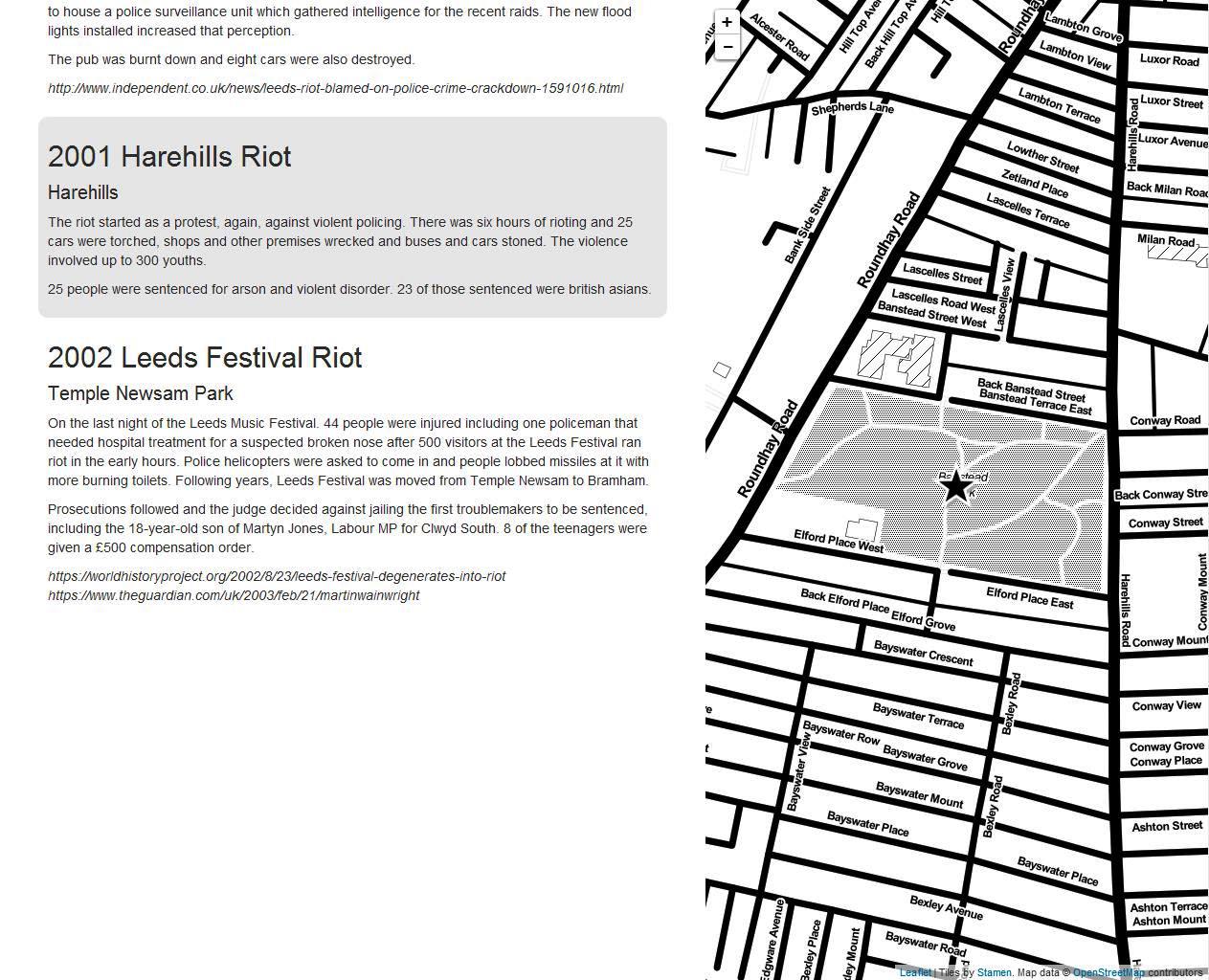
THE RIOT MAP SERIES
That’s why I value my final set of maps: a selection from our ‘Riot Map’ collection. These were originally created by Tim Waters for a website of the same name and plot the locations of protests and demonstrations throughout Leeds history.
These range from the broadly familiar – the 1643 Battle of Briggate – to less-well-known struggles, such as the 1753 Turnpike Riots, through the Chartist demonstrations of the 19th-century and onto late 20th-century protests or disturbances, such as those taking place between 1975 and 2001.
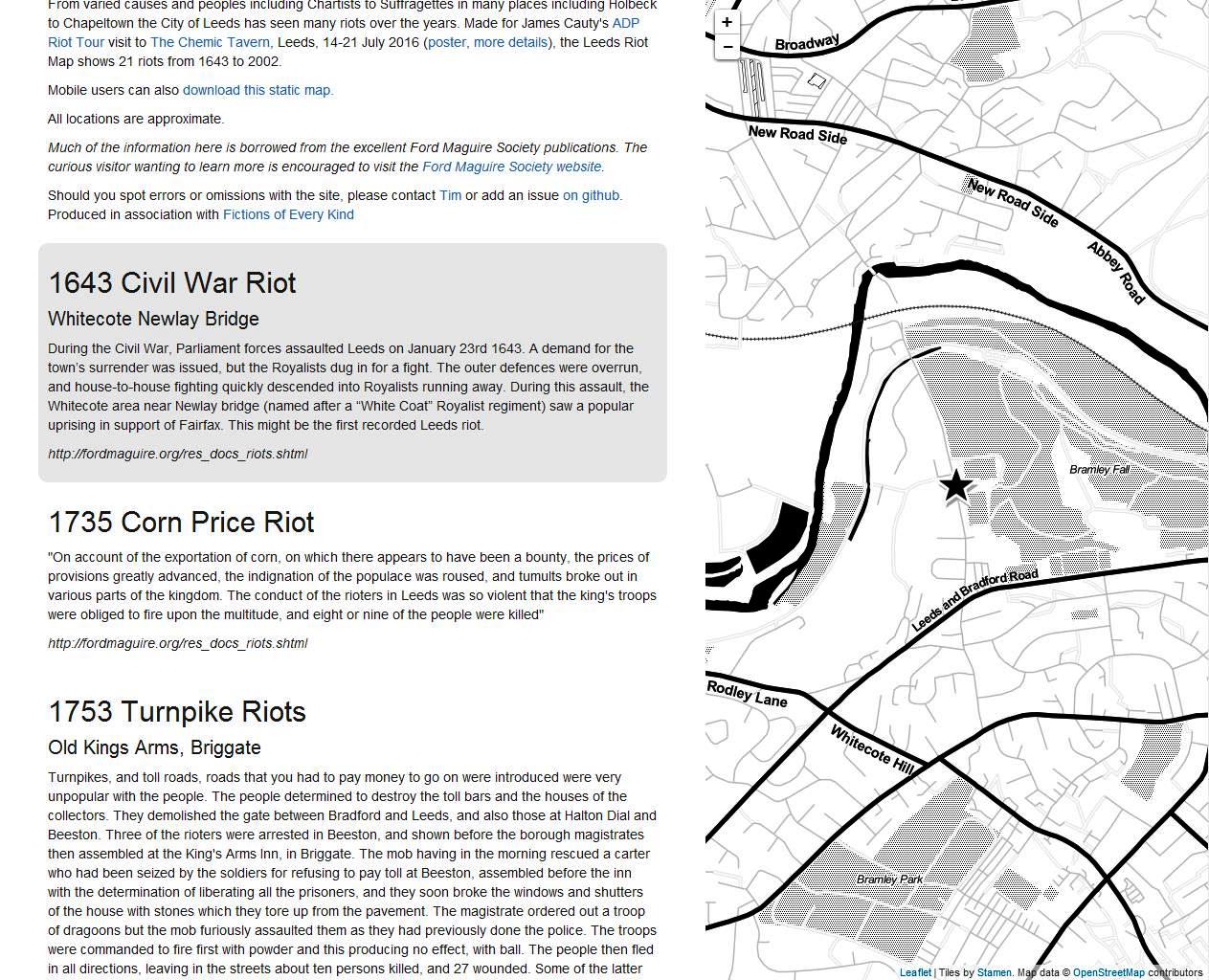
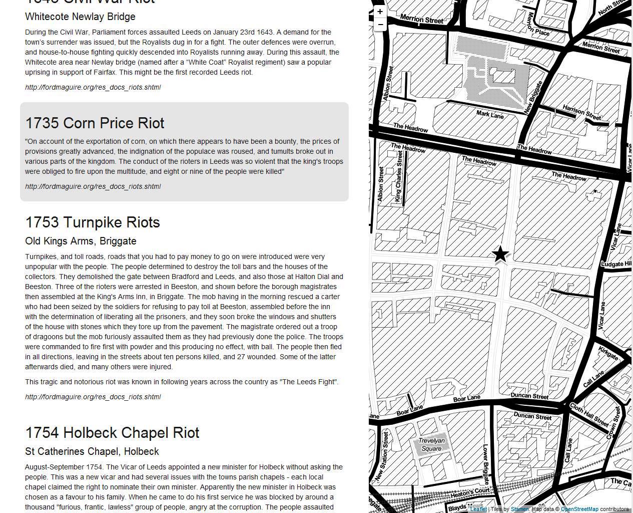

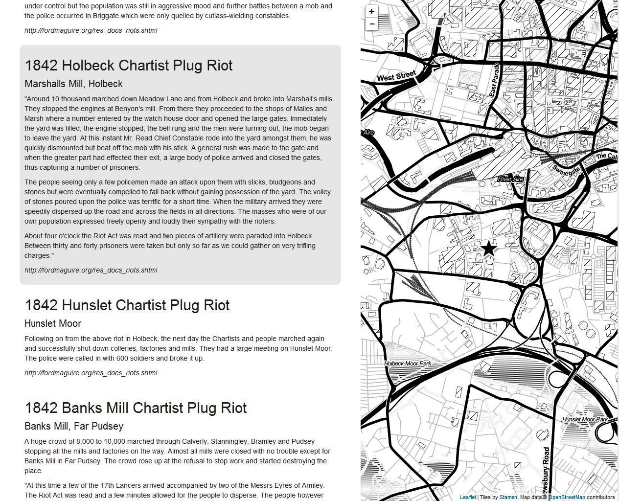
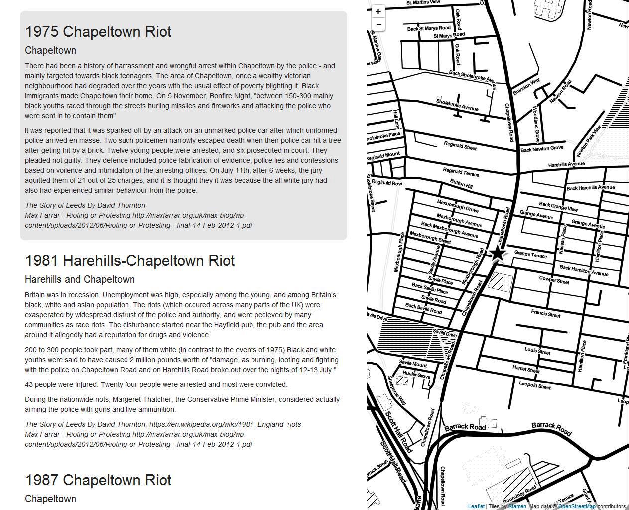
These maps are important, I think, because, while the other maps we’ve looked at are rather coy about their subjectivity, their roots in structures of power and legal control, these maps actively foreground those social systems: by focusing on instances where individuals or groups have acted to break, subvert or overthrow those chains of hierarchy, the Riot Maps make social inequalities explicit and unavoidable.
In contrast to Cossins, for instance, whose map conceals the urgent realities of conflict and negotiation in urban life, the Riot Map series instead brings to the fore the experiences of the unheard and the unseen, revealing exactly what is missing from so many other cartographical representations of Leeds’ past.
In doing so, the Riot Maps disrupt conventional approaches to politics, maps and the past – mainstreaming a history of protest rather than a history of power and drawing attention to the socially-constructed nature of all maps in the process. They show us, in short, that history – and the cartography, the maps, underpinning many of the stories we tell about that past – is entirely a matter of contested meanings, both then and now.
To find out more about viewing any of these maps, or our map collection more generally, please contact the Local and Family History department on 0113 37 86982 or via localandfamilyhistory@leeds.gov.uk
