Assistant Librarian Antony Ramm takes a look at a new addition to the Local and Family History department in the Central Library.
The recent arrival in our Local and Family History department of a new map series is to be welcomed. This is the Leeds Riot Map collection, originally created by Tim Waters for a website of the same name (and drawing on text from the Ford-Maguire Society), and now added to our local history collections. The series – a set of 19 maps – plots the locations of riots and other demonstrations throughout Leeds history, from the broadly familiar – the 1634 Battle of Briggate – to less-well-known struggles, such as the 1753 Turnpike Riots, through to the various Chartists demonstrations of the 19th-century and on to late 20th-century protests such as those in 1975, 1981, 1987, 1995 and 2001.
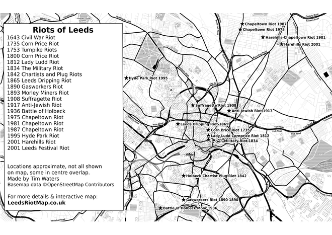
More than just their value as a factual guide to each protest, however, these maps are truly essential for the way they disrupt conventional approaches to power, politics and the past, allowing for a radically new perspective on previously familiar events in Leeds history: “a history of protest rather than power“. More specifically, the Riot Map series adds depth to our current collection, subverting conventional approaches to cartography and drawing attention to the constructed nature of all map-making.
*****
Maps are not ‘maps’. That is to say: maps are never neutral, and objective and scientific – they always reflect the ideologies of the societies that produce them, much more than depicting any physical ‘reality’. Maps seek to impose order onto the chaos of the natural world, set boundaries and limits, organise – and allow for the exploitation of – information, and define inclusion and exclusion from certain spheres (nations, most notably).
In this sense, maps are essentially about knowledge; and knowledge is just one link in the chain toward control; and control is essentially about power: struggles over which lie at the heart of all politics: “Maps have always been part of the imposition of power over colonised peoples. While map-making might be thought of as ‘objective’, it is fundamentally political, a necessary part of controlling a territory. Maps inscribe borders, which are then used to include some and exclude others.”
*****
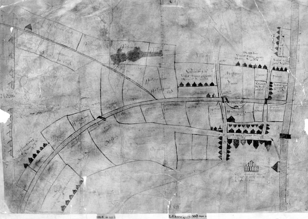
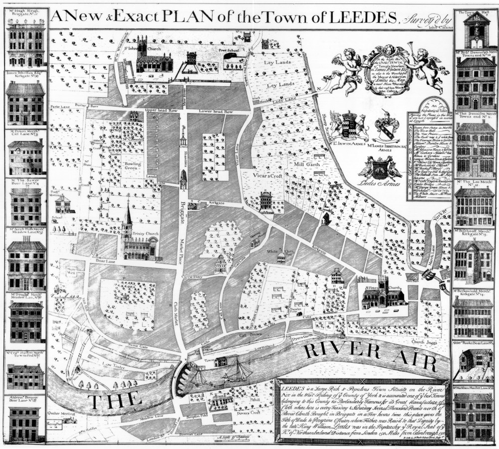
The Map Collection in the Local and Family History department reflects, for the most part, this ideologically-charged definition of maps, their creation and their purpose. Most early Leeds maps, like the so-called ‘first map’ of Leeds from 1560, are almost entirely about land ownership – who has it, who is claiming it; who is selling it, who wants to buy it – or they are more general representations of a mercantile and commercial world-view: John Cossins’ 1726 map, for instance, is famously bordered by images of houses belonging to the wealthiest merchants in the town. Very little detail of life in 18th-century Leeds can be ascertained in Cossins’ map beyond the spaces used by elites and their networks – the Churches, the Cloth Halls, the trading routes – making a mockery of its title: “A New and Exact Plan of the Town of Leedes.” (emphasis added)
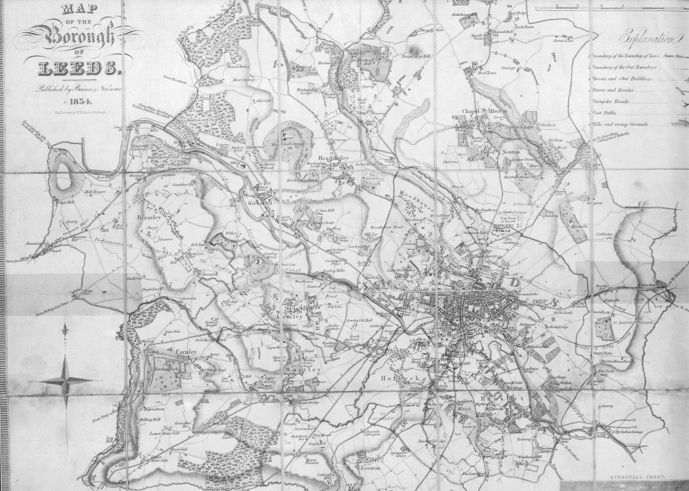
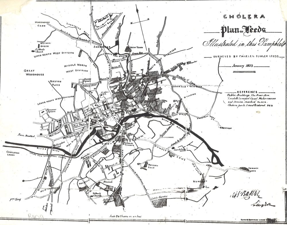
Other maps are less explicitly about power, but are even so: Baines and Newsome’s 1834 map of the town was created to accompany a trade directory – and the clue is right there, in the name: these are maps for the trader, the seller of goods, the industrialists – who do I need to know in this town and where can I find them? Later maps are dominated by the official Ordnance Survey series, whose usefulness to local and family historians should not obscure the essential nature of their existence: the imposition of order onto the chaotic realities of urban topography; the camouflaging of dispute, discord and dispossession.
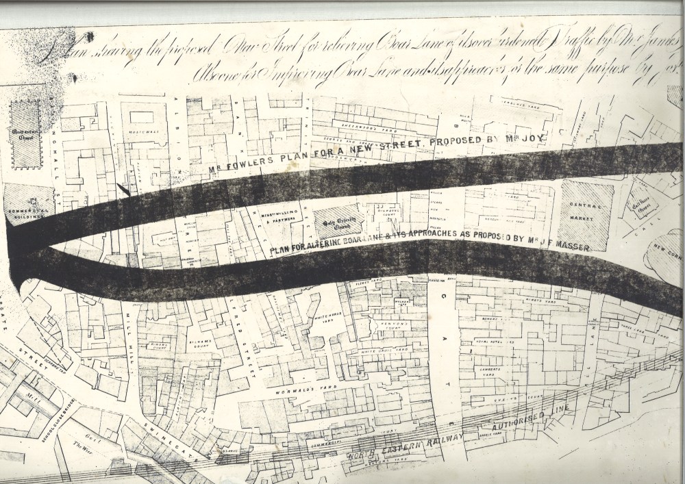
Some examples: a large group of the Leeds map collection relate to town development and, specifically, to proposed or real changes to buildings and transport routes. The language of these maps and plans, both visual and textual (“improvements”), is technocratically sanguine, with a friction-less opacity that works to smooth away the contested nature of all urban negotiations. Non-elites – those without power; those whose lives are most often uprooted or devastated by such ‘improvements’ – are rarely represented or seen in these supposed ‘windows into the past’ (the old – if problematic – story of historical evidence favouring the ‘victors’).
*****
Which is where our new series comes in. While these maps can not hope to recover the actual lived experiences of protesters, their framing as a discrete set at least situates those alternative voices as an unavoidable fact in the wider story of Leeds. Indeed, we could even say: challenges to authority always imply unequal relationships with power; by making the fact of that inequality explicit, the Riot Map series works to contextualise all other approaches to Leeds history in the same light, making the disputed nature of events an obligation of any future narrative or interpretation. By literally mapping these counter-narratives onto the standard topographical model of the city, the point is made double: history – and the cartography that underpins many of those stories – is entirely a matter of contested meanings.
*****
That’s one possible starting point, at any rate: further uses and analysis of these maps and the events depicted lay in the hands of future researchers. To view the Leeds Riot Map Collection, please visit the Local and Family History library, or contact us on localandfamilyhistory@leeds.gov.uk / 0113 37 86982.

5 Comments Add yours