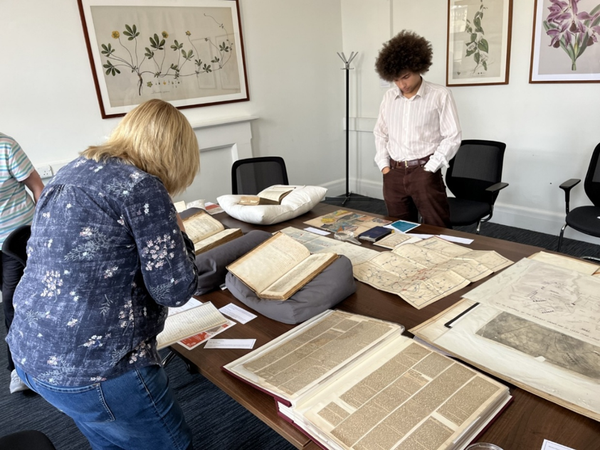
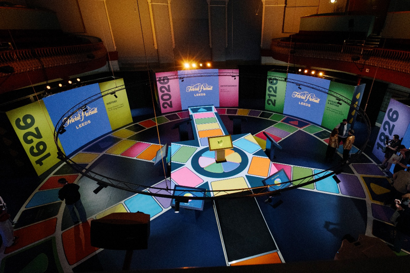
As part of the Trivial Pursuits project, which has been put in place to celebrate Leeds 400, the library put on a series of ‘Treasures Showcases’ for each of the Trivial Pursuit categories. In August, the themes were Geography and History and items from our Special Collections department were taken out to be displayed and handled by the public.
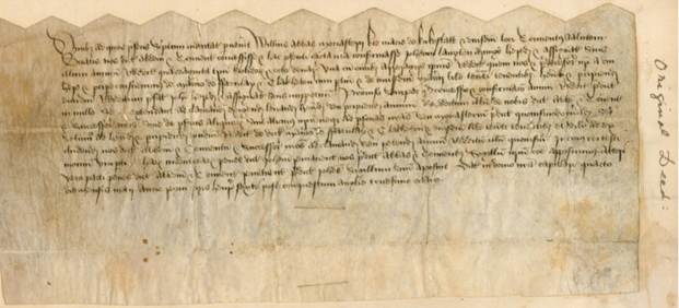
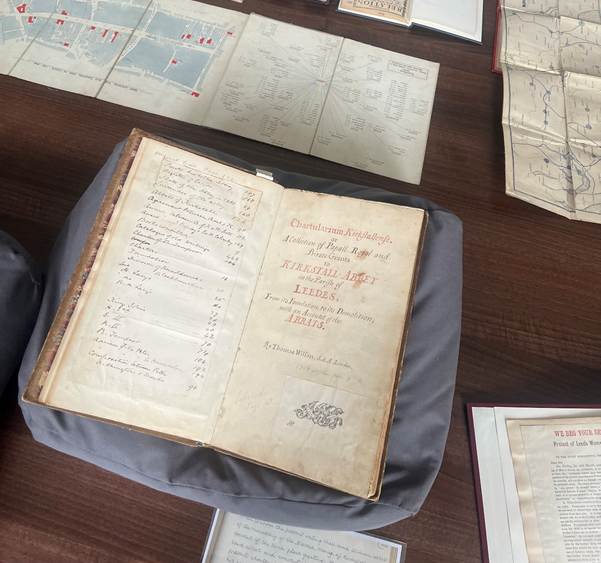
Starting off with the history category, we began with one of the library’s earliest collection items, named the Chartularium Kirkstallense [SR Q 271.12 WIL]. This book is a compilation of documents and inventories of the Kirkstall Abbey library, complied in 1758 by the Leeds born antiquarian Thomas Wilson. Although the date of the work is old, the book also contains something far older and extraordinary: an original charter from the Abbey, dating back to 1460. It is thought that most of the book’s contents were mysteriously found inside a chest within the attic of a house in Chapel Allerton, presumably there since the dissolution of Kirkstall Abbey in November 1539. The item offers a glimpse into the abbey’s past, detailing around 200 historic documents and deeds.
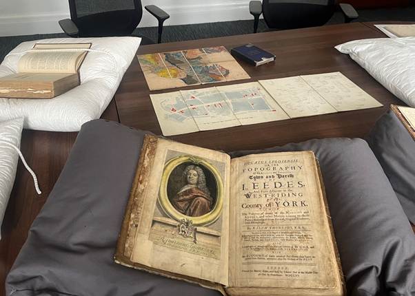
Next is an item from 1715, named Ducatus Leodiensis [SR Q 942.81 THO], which is the first written history of Leeds. It was written by the antiquarian Ralph Thoresby – through him we have the Thoresby society, as well as many collections at Leeds City Museum. The library holds many copies of the Ducatus, including one annotated later by Thomas Wilson. Wilson’s amendments and revisions to Thoresby’s text were incorporated into Thomas Dunham Whitaker’s second edition of the Ducatus, published in 1816.
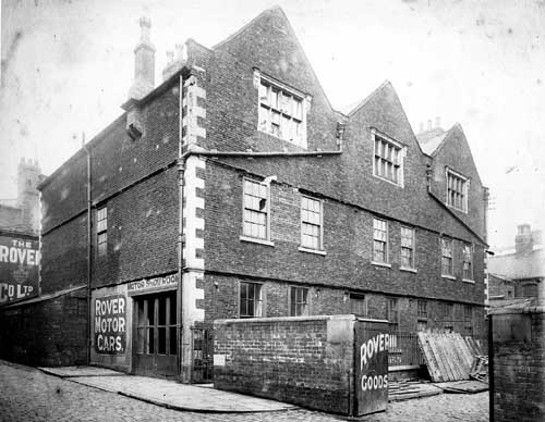
The Ducatus covers the geography, heritage, and historical records of the city. One historical event that is detailed is the English Civil War and its presence in the city of Leeds. Among various battles, Charles I was imprisoned in the city, at a place called the Red Hall on the Headrow.
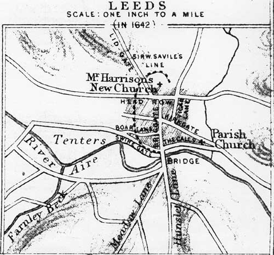
On the subject of the civil war, the next item to take a look at was the memoirs of Thomas Crompton who served as chaplain during the Battle of Briggate, titled ‘A true and plenary relation of the great defeat…’ [STC (WING) C7031]. This battle, also often called the Battle of Leeds, was fought between Royalists and Parliamentarians in January 1643. It was won by parliamentary forces of around 3,000 men led by Lord Fairfax against the Royalist garrison of about 2,000 men commanded by Sir William Savile. This first-hand account details the makeup of the Parliamentary troops, noting that many were very young soldiers recruited rapidly around Bradford and Halifax. The item forms part of the Wing collection, which contains numerous accounts and documents relating to the English Civil War.
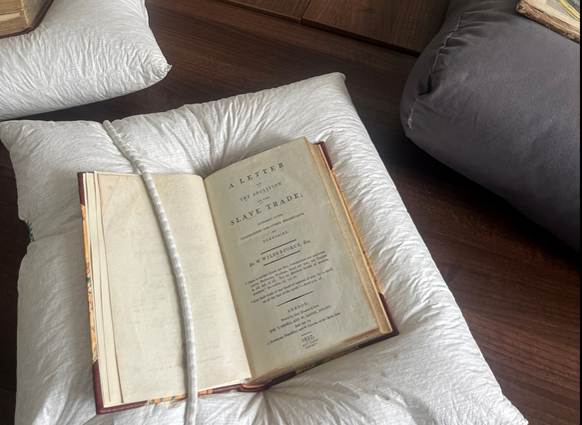
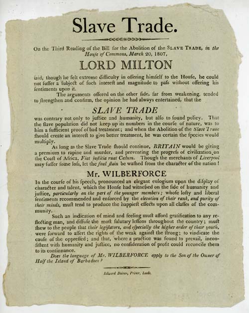
Moving into the 19th century, we then looked at William Wilberforce’s ‘A letter on the abolition of the slave trade: addressed to the freeholders and other inhabitants of Yorkshire’ [SR 326 WIL]. This work was written in 1807, being a major influence on the Slave Trade act of the same year, which made the trade of enslaved peoples illegal across the British Empire. However, it took until 1833 until slavery itself was made illegal. William Wilberforce was an MP from Hull and regularly visited northern towns such as Leeds on campaign. He was part of a wider context of abolitionists in Yorkshire and an anti-slavery presence in Leeds. This often comprised of quakers such as Wilson Armistead, as well as freed slaves who came to campaign and seek refuge in the city. Figures included Henry ‘Box’ Brown, William and Ellen Craft, Olaudah Equiano and Frederick Douglass.
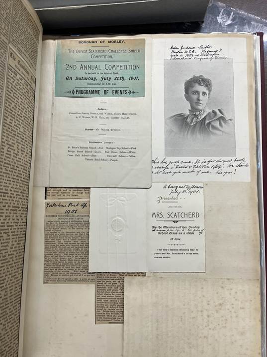
Lastly for the History subject, we looked at Alice Cliff Scatcherd’s Scrapbook [SCAT B SCA], made between 1880-1904. Scatcherd was an early suffragist, who was born and worked in Leeds. Her activism included campaigning for women’s rights, animal welfare and worker and trade union powers. She served as secretary and active leader for the Leeds Suffrage Society (a local branch of the National Society for Women’s Suffrage) and co-founded the Women’s Franchise League in 1889. Further, she helped set up the Women’s Trade Union League in Yorkshire, assisting in a six-week strike by female power loom weavers. Scatcherd also took on a political dimension, as she served as Lady Mayoress of Morley twice.
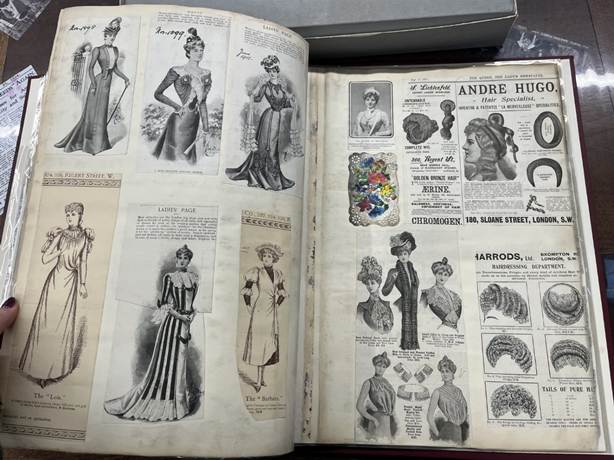
This scrapbook details news cuttings about her campaigns, letters to the local press about women’s rights, as well as civic invitations and fashion plates. Scatcherd was part of a wider suffragette presence in Leeds, amongst people such as Leonora Cohen, Mary Gawthorpe, and Isabella Ford. Scatcherd is active just before events of civil unrest and major political reform, such as the 1908 procession on the town hall, arrest of Cohen in 1913 and the eventual Equal Franchise Act in 1928.
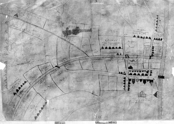
Moving on to the category of Geography, we took a look at a few overlapping documents – maps that are also historical records of the past. First up, a facsimile of the first ever known map of the city of Leeds, created in 1560 [ML 1560]. Drawn up as part of a legal dispute between the tenants of the Queen’s Mill and Thomas Falkingham of the North Hall manor, which was carved out of the manor of Leeds itself in the 12th-century. Although a map of Rothwell from 1531 is our earliest in our collection, this is the first known map of the centre of Leeds. The map presents a very different area to the one we know today, showing the 11th-century manorial corn mill located by the river at Swinegate and the unauthorized mill built by Thomas Falkingham near Sheepscar Beck, later Millgarth. It does display the River Aire, Briggate and the Headrow.
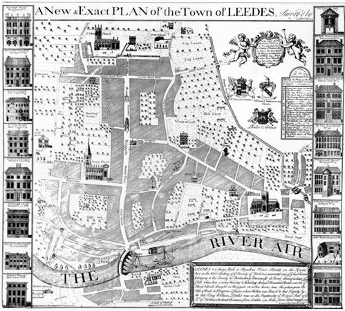
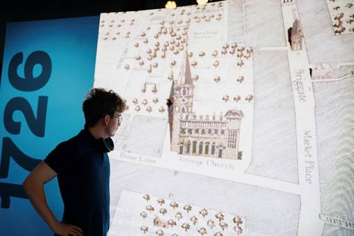
Next is perhaps the most commonly used historical map of Leeds, the 1726 Exact plan of the Town of Leedes by John Cossins [ML 1726]. Cossins was an early cartographer whose notebooks reside at York Archives. By the number of buildings and lavish decoration of the map itself, it is clear this map showcases a more populated and wealthier city. It highlights industry landmarks, including the first White Cloth Hall, although leaves out crucial details such as ordinary worker housing. The original is at Leeds City Museum and was blown up in the central court to promote the trivial pursuits wedge for ‘Geography’.
More geographical items that the library holds, also relating to the industrial history of Leeds, are maps of various railroad networks. This includes a map titled ‘An historical sketch of the Manchester and Leeds Railway, as far as completed : with descriptive notes on the most remarkable objects near the line’ [SR 385.09427 MAN]. The Manchester and Leeds Railway was engineered by George Stephenson and Thomas Longridge Gooch, connecting Lancashire and Yorkshire through the Pennines, opening fully in 1841. It later became the Lancashire and Yorkshire Railway. The creation of it required carving a massive 1.5-mile tunnel near Todmorden across the Pennine watershed, which was one of the longest rail tunnels in the world at the time of its completion. It was one of the early railway networks, although Stockton and Darlington Railway opened in 1825 and Yorkshire’s Leeds and Selby Railway opened in 1834. The map itself was drawn up by topographer and writer Edwin Butterworth.
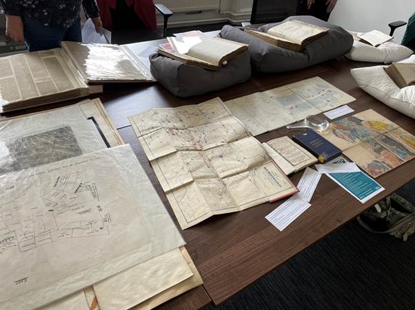
Next up was some more linked social history, being the construction of sanitation systems in the city of Leeds. On show was the ‘Leeds New Water Supply’ [SRP Q 628.1 LEE] map of 1866. With a change of industry and rapidly growing population in the 19th century, implementing sewage and sanitation systems was vital. Before this, domestic and human waste would be deposited into the streets, sometimes into designated heaps. A cholera epidemic in 1832 spurred the need for change, leading to the 1842 Leeds Improvement Act, which gave the Leeds Corporation unlimited legal rights to build sewers. However, hold ups in the project meant another outbreak occurred in 1849. Our industrial past relied heavily on the water systems of Leeds, powering our city’s mills. Our current rivers and water systems include the River Aire and River Wharfe, as well as the Leeds and Liverpool Canal, Aire and Calder Navigation and old Mill Races (Goits).
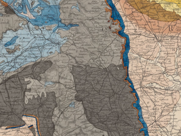
We then looked at the geological makeup of the area, with the mapping of rock formations being another 19th century phenomenon. The library holds many interesting and historic geological maps, including the 1866 Geological map of England & Wales [554.2 RAM] By Andrew Ramsay. As seen in the image below, the geological makeup of Leeds has coal measures and millstone grit predominately. The contributor to the Yorkshire region covering the city of Leeds was Alexander Henry Green, who also wrote library collection item ‘The Geology of the Yorkshire coalfield’ [554.2 GEO]. This book is a survey documenting the stratigraphy and structure of carboniferous strata from Leeds to Sheffield.
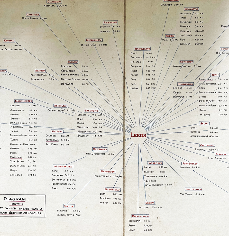
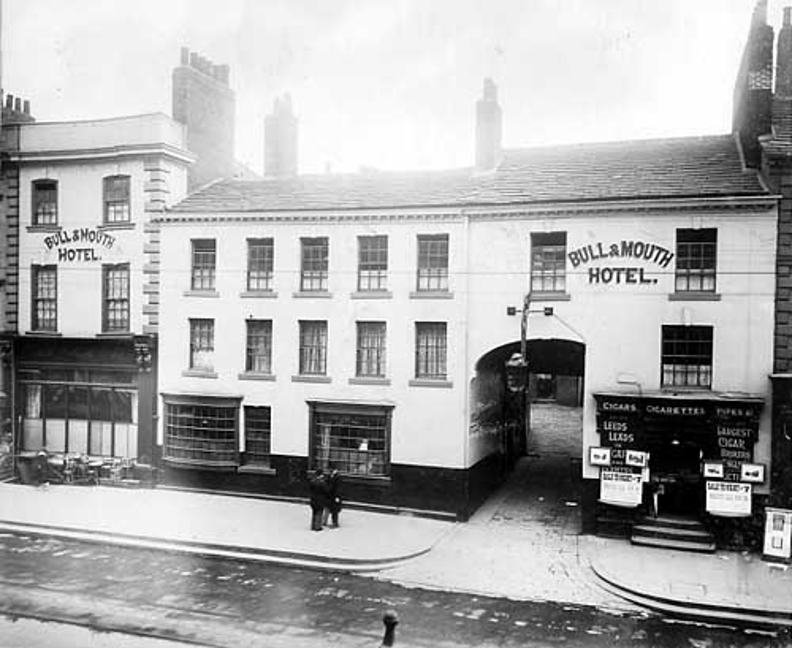
Moving into the 20th century, we looked at something from the collection of the philatelic society – a map titled ‘The old coaching inns of Leeds’ [SRP Q 388.32 SID] by antiquarian John K. Sidebottom. Coaching inns were used predominately in the 17th and 18th century, functioning as roadside posting houses where horse-drawn stagecoaches and travellers stopped for food, drink, and overnight lodging.
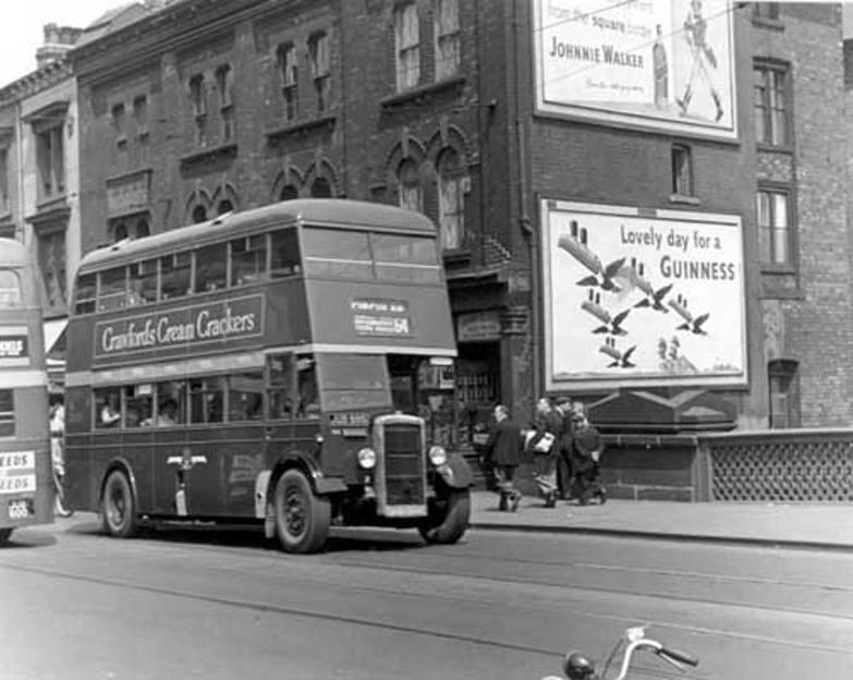
We then looked at some more modern transport networks, including a Bus Route Map [ML 1962] from the 1960s. These networks began as horse-drawn omnibuses, then evolved into the systems we have today. The final Leeds tram lines closed in November 1959, meaning the 1960s network map reflects an all-bus system transitioning to handle growing outer housing estates and ring roads. The buses in use would have been green and cream motorbuses, such as the one pictured below.
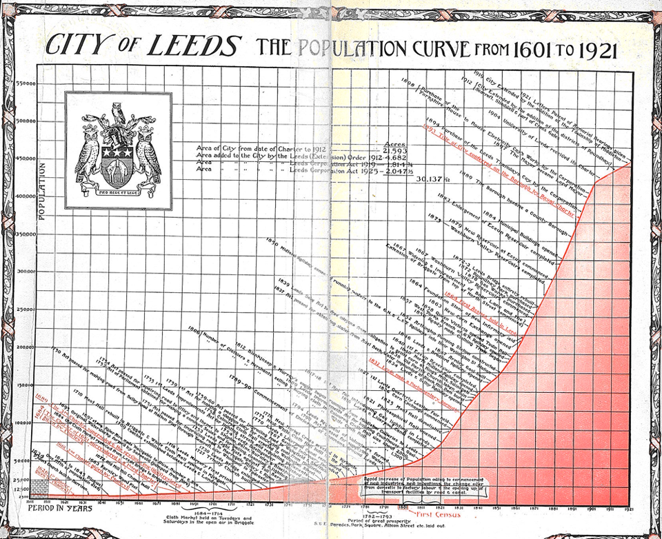
Lastly, in an effort to tie in geographical population statistics, with the history of the city, a graph was shown inside the information pack given out to attendees. This was taken from the handbook of the 1926 exhibition of Leeds tercentenary (or Leeds 300!) ‘Handbook of the Old Leeds exhibition, held in the City Art Gallery, July 8th-23rd, 1926’ [L 942.819 HAN].
Thank you to all those who came along! If you missed it, remember these items are available to view in the Heritage and Research Department on the 2nd floor of Leeds Central Library. Please bring proof of address and email in advance to avoid disappointment.